

Hurricane Genevieve is spinning about 500 miles south of Baja California as of July 28. Winds have reached 160 miles per hour at their fastest point. The weather was like a tropical depression three days ago. That kind of rise doesn’t happen very often, and when it does, it often surprises everyone, even the meteorologists who watch it hourly from space. The National Hurricane Center said that its own peak wind speed prediction of 160 mph might be too low. No one writes that sentence unless they really mean it.
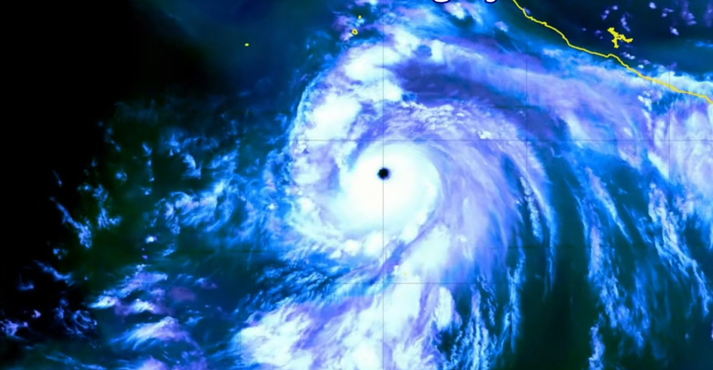
In the Eastern Pacific, Genevieve was the first Category 5 storm of 2026. It briefly crossed that threshold on Monday morning, but an eyewall replacement cycle, which is a strange, self-reorganizing structural event that happens inside very intense hurricanes, pushed it back down to Category 4. The steady winds slowed down to about 155 mph, and the central pressure dropped to 925 millibars at its lowest point. To give you an idea, it was at 993 millibars on Saturday when it was still a tropical storm. That’s an incredibly big drop in an incredibly small time frame.
Genevieve was very explosive because a lot of things were almost perfect. The sea’s surface is about 30°C. Low shear in the wind. It was the deep ocean’s heat content that kept the storm from mixing up cooler water and going hungry. A small, tight core that tightened and spun up well, like a figure skater pulling her arms in. When there is a strong El Niño, the Eastern Pacific acts like a pressure cooker for this kind of storm. Before the season even began, NOAA said that this basin could see up to nine major hurricanes. Genevieve is the first one. Most likely, it won’t be the last.
It’s interesting to think about the eyewall replacement cycle that Genevieve is maybe going through right now. A new outer eyewall forms around the first one, cutting it off from its fuel supply. This temporarily weakens the storm until the outer wall contracts and the system may get stronger again. Forecasters called it a “wild card” for Genevieve’s strongest point. The storm could stop, get a little weaker, and then surge again, or it could keep getting weaker as it moves into cooler water later this week. No one is sure of the exact path it takes. At least from a meteorological point of view, that uncertainty is really interesting. In terms of safety, this means that people shouldn’t think the worst is happening just yet.
Right now, people don’t need to worry about Genevieve making direct landfall because she is moving northwest into the open ocean and, according to current models, doesn’t pose a threat to any major populated coastline. It’s making waves that are very dangerous. Already, waves from the storm are making life-threatening rip currents along the beaches in southwestern Mexico and the southern Baja California Peninsula. By Tuesday night, those conditions should have moved north along the Pacific coast of Baja California. It’s not the kind of danger that makes the news like a direct hit does, but people who don’t pay attention to the water often die from it.
Genevieve is the seventh named storm of the 2026 Eastern Pacific season. Because of El Niño, NOAA said that this season had a 70% chance of being above-normal. All five of the first named storms started before their normal date. Meteorologists are keeping a close eye on this pattern, and Genevieve is less of a surprise and more of a confirmation. This was going to happen this season. It was warm enough in the ocean. The weather conditions were good. And in less than 72 hours, a storm went from being a depression to a likely Category 5 storm.
Genevieve is expected to slowly get weaker once it enters cooler water around midweek. By August 1, it should be only a tropical storm. At the same time, Hurricane Fausto is moving toward Hawaii. This is another system, another set of surf warnings, and another week in the Pacific that is shaping up to be a very busy one. The season is still young. We still have a long way to go.
