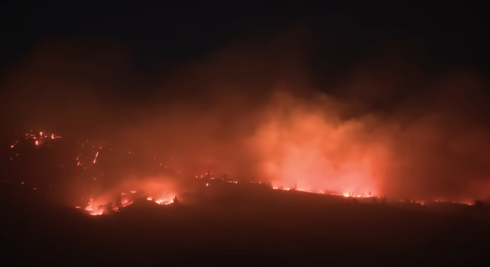
The once peaceful ridgelines around Lyle, Washington, have been drastically changed into hot, ashy, and smoke-filled battlegrounds in recent days. Since its inception on July 18, the Burdoin Fire has spread at an alarming rate, encompassing over 10,700 acres. The fact that this fire is still completely uncontrolled is especially devastating. Yet, almost 850 firefighters are trying to hold the line through a very effective, well-coordinated response before more homes and lives are put in danger.
Dry terrain and wind gusts of almost 35 mph, which are dangerously common during the hotter months in the Pacific Northwest, have contributed to the fire’s aggressive spread. Crews are fighting the force of nature by establishing fire breaks along Major and Catherine Creeks with the use of fixed-wing aircraft and water-dropping helicopters. Although the entire perimeter is still dangerously unstable, these intricate operational efforts are showing remarkable success in slowing the spread of the fire in some areas.
Families along State Route 14 and Old Highway 8 have had their lives upended in recent days by evacuations. Red Cross shelters have turned into temporary havens for locals who were just hours earlier basking in the summer heat in their own backyards. The atmosphere at Grace Baptist Church and The Dalles Middle School is solemn. In equal measure, volunteers distribute comfort, water, and blankets. One woman, who escaped with her dog and two kids, talked about the anxiety of cramming everything she owned into a hatchback in less than fifteen minutes. With tears visible behind smoke-tinted glasses, she remarked, “You never think you’ll be the one running.”
Burdoin Fire Washington – Key Incident Details
| Event Name | Burdoin Fire |
|---|---|
| Location | Lyle area, Klickitat County, Washington, USA |
| Acres Burned | 10,730+ acres (as of July 22, 2025) |
| Date Started | July 18, 2025 |
| Cause | Under investigation |
| Homes Destroyed | 14 residences confirmed |
| Homes Damaged | 37 residences |
| Structures Threatened | Over 250 |
| Total Personnel | Approximately 850 firefighting and emergency crew members |
| Containment Status | 0% containment (as of last update) |
| Closures | SR-14, Hwy 142, Centerville Hwy; multiple trails in Columbia Gorge |
| Emergency Shelters | Grace Baptist Church (White Salmon), The Dalles Middle School (Oregon) |
| Source Link | www.statesmanjournal.com/story/news/local/2025/07/22/oregon-wildfire-updates-burdoin-fire-grows/85322775007 |

Communication has remained exceptionally clear thanks to strategic partnerships between state officials, local emergency teams, and the U.S. Forest Service. Quickly, closure notices were posted for important recreational areas, such as the well-known Coyote Wall, Klickitat Trailhead, and Catherine Creek Recreation Zone. In contrast to previous fires where warnings came too late, noticeably better agency coordination has helped prevent additional public danger. Response teams this time had planes in the air and boots on the ground in a matter of hours.
Particularly instructive in the context of fire management is the Burdoin Fire. It highlights the increasing conflict between environmental vulnerability and natural beauty. The Columbia River Gorge, renowned for its colorful hiking trails and sheer cliffs, is remarkably adaptable but also becoming more and more delicate. More communities like Lyle might experience similar crises in the years to come as warming trends continue and fire seasons lengthen. Long-term solutions could be greatly enhanced by combining early detection technologies, vegetation thinning, and controlled burns.
Every spark has a corresponding financial cost. It is anticipated that insurance claims will increase. Repairing infrastructure, such as restoring roads, replacing utilities, and restoring the environment, could take months. As tourism drops, trails remain closed, and families who have been affected by the fire struggle to rebuild, the economic aftershocks will be felt in neighboring towns. Amazingly, though, there is still hope. A particularly strong sense of community spirit is evident as residents are already talking about cleanup and reconstruction teams.
The air quality response has been one crucial but often-overlooked aspect of this crisis. The Hood River area’s air quality is still “good” according to federal AQI standards despite the size of the fire, in part because of changing wind patterns that have kept the smoke away from areas with high population density. However, medical professionals advise people with respiratory sensitivities to stay indoors. Updates are still being disseminated remarkably quickly via town bulletin boards, social media, and emergency alerts.
Fire modeling has directed crews toward important containment zones by utilizing early aerial data. Citizens can now keep an eye on developments and get ready for changing evacuation notices thanks to real-time tools like Watch Duty and CalTopo. In a time when uncertainty can paralyze people, this digital transparency has become an indispensable tool.
The Burdoin Fire is influencing a new perspective on climate and community, particularly among younger residents. During a shelter activity, a middle school student drew the fire perimeter on a chalkboard, and local educators are already using real-time maps to create lessons. Even though they are the result of crises, these kinds of moments foster empathy and knowledge that will be essential for generations to come.
The way the area is using this fire as a turning point is especially creative. Officials and environmental organizations are working together to reconsider forest management in the Gorge’s surrounding areas. There is a rush to draft grants for wildfire education, new irrigation infrastructure, and home-hardening projects. Leaders are preparing for the next challenge rather than just responding to it.

