

It looked like eastern Wisconsin would have a low-level storm on Monday afternoon. There was a higher chance of severe weather, but the threat of tornadoes was only moderate. This is the kind of forecast that doesn’t usually make people rush to their basements. Then, around noon, a confirmed tornado hit the west side of Appleton and moved southeast toward Menasha, sending debris into the air and leaving behind damage that takes days to fully document.
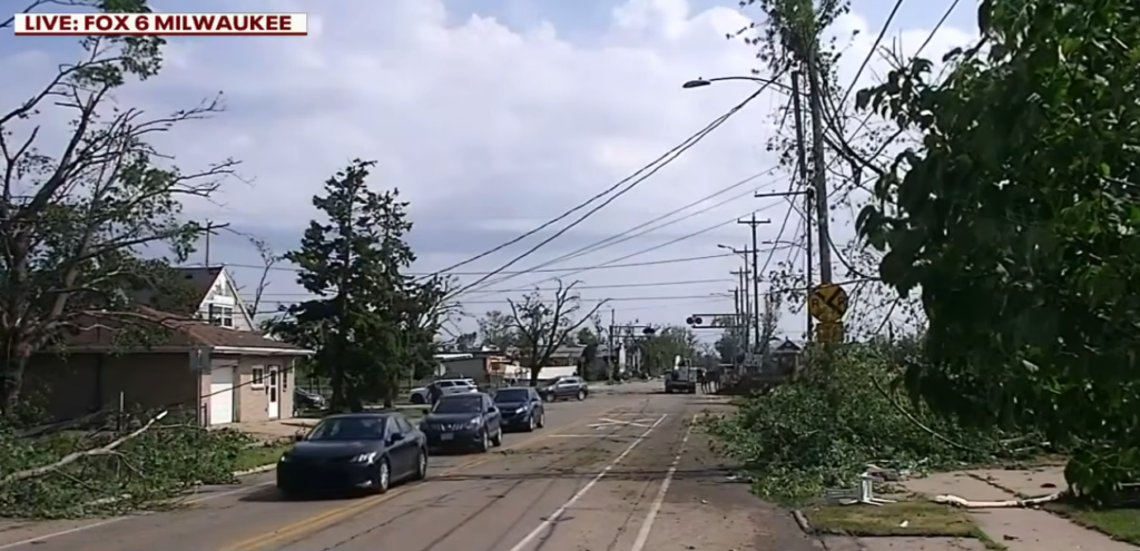
Miller Electric’s roof on South Perkins Street in Appleton caved in on itself. Trees and power lines fell all over the city. Prospect Avenue and Highway 441 were closed by police. The Appleton Police Department released pictures of streets full of broken glass and downed power lines that crossed roads. The pictures also showed the eerie silence that comes after a sudden disaster. Officers said they were getting calls about the storm faster than they could answer them. Two people watching the storm from a car on the highway said they just barely got away when the tornado went right in front of them.
At about 40 miles per hour, the tornado moved southeast toward Menasha, Darboy, Kimberly, Kaukauna, and Little Chute. The National Weather Service sent out a Particularly Dangerous Situation tornado warning, which is only used when there are confirmed, strong, and life-threatening tornadoes. Reed Timmer, an extreme weather meteorologist who caught the storm in real time, wrote on social media that it was violent, and video showed a wide funnel of debris tearing through buildings. Early radar and damage assessments showed that winds could reach 140 to 160 miles per hour, which would put the storm in the EF3 category and possibly close to the EF4 level. Based on their survey, the National Weather Service says it did EF3 damage. This would be Wisconsin’s fourth tornado of this type in 2026.
Menasha was hit the hardest. Videos going around the internet showed parts of Main Street with homes and businesses destroyed, cars on their sides, and trees bare. The City of Menasha Police Department warned people not to go into the area unless they had to in an emergency travel advisory. Quickly, emergency cooling centers were set up at Christ the Rock Church, the Menasha Senior Center, and the Menasha Public Library. This was the immediate, practical response to a disaster in a town whose afternoon had just been thrown off by wind. Neenah, a nearby city, also sent out a warning, telling people to slow down while cleanup crews looked at the roads.
PowerOutage says that as of Monday afternoon, about 75,000 homes and businesses across the state had lost power.More than 15,000 of those outages were in Outagamie County, which is where Appleton is located. On the same day, tornado warnings were sent out for parts of Indiana and Illinois, including some of Chicago. This suggests that this wasn’t just one area of bad weather, but a larger outbreak of severe weather that was moving across the Midwest.
The fact that this storm happened on a day when there was only a slight chance of tornadoes is something to think about. That’s not a flaw in meteorology; it’s still really hard to predict tornadoes within exact windows, and “marginal risk” doesn’t mean “zero risk.” But it serves as a reminder that a normal storm day can turn into a terrible one very quickly, and that you should pay attention to the warnings when they come, even if the sky doesn’t look particularly dangerous. People in Menasha who got inside quickly probably only had a few minutes between the first tornado warning and when it hit.
The damage check will take some time. In the next few days, National Weather Service teams will walk the path and measure the damage to get a better idea of whether this is an EF3 or an EF4 storm. The exact rating probably doesn’t matter as much to the people on Prospect Avenue or Main Street in Menasha who are looking at smashed cars and roofs on a Monday afternoon. What matters is what comes next: cleanup, repairs, and the slow process of figuring out what was lost.
