

On Monday, August 10, Spain awoke to yet another weather report that was both foreseeable and concerning. Ten autonomous communities have been placed under active alert by the nation’s meteorological agency, AEMET; some are for intense heat, others for violent storms, and a few for both at once. It’s the kind of prediction that might have seemed out of the ordinary ten years ago. It reads more like routine now.
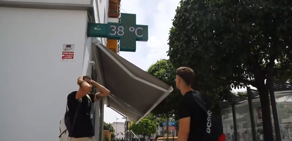
The image of the temperature is striking. Throughout the afternoon, temperatures in the Guadalquivir valley are predicted to rise above 40 degrees Celsius. While cities like Granada, Jaén, Toledo, Zaragoza, and Palma are all headed toward 38°C, Córdoba is expected to reach 39°C. In contrast, Madrid’s predicted temperature of 36°C seems almost moderate. These aren’t isolated records; rather, when combined across numerous provinces at once, the figures depict persistent, pervasive heat that is truly wearing people out.
The storm risk is approaching at the same time, which makes this particular weather setup unusual and, to be honest, a little unsettling to watch. The eastern third of the nation and the northern mountain ranges are predicted to experience shower and thunderstorm activity by the afternoon. The Comunitat Valenciana, the southern Sistema Ibérico, the southeastern peninsula, and Navarra have all been designated by AEMET as regions where storms have the potential to become severe, bringing with them large hail, extremely strong wind gusts, and locally intense rainfall in a brief period of time. People are often taken aback by the contrast of heat and hail on the same afternoon in different parts of the same nation.
Active storm alerts are in effect for Aragón, Castilla-La Mancha, Cataluña, the Regación de Murcia, La Rioja, and Navarra. High-temperature warnings are still in effect for Andalucía, Baleares, the Community of Madrid, and a number of other places. Looking at the map, it seems like almost nowhere is experiencing a pleasant day.
Nor are the nites providing much respite. For most of the southeastern coast and the island territories, AEMET is predicting “tropical nights”—minimum temperatures that remain above 20°C. Overnight lows may stay above 25°C in some Mediterranean coastal locations. Long-term warmth is more important than people sometimes realize. Heat-related sleep deprivation builds up, and nites like these pose a serious health risk to elderly people or those without air conditioning.
Galicia, the Cantabrian coast, and the area surrounding the Strait of Gibraltar are predicted to experience morning fog and coastal mist, but the majority of the interior should see clear skies throughout the morning. It’s still unclear if the afternoon storm cells will remain dispersed and largely contained or if they will develop to the full intensity that AEMET is flagging. There is uncertainty in convective forecasting at this range. Phrases like “locally very strong” and “cannot be ruled out” typically appear when forecasters are genuinely unsure of how severe a storm might get, so the agency is not being casual about the wording.
The solar eclipse on August 12th is looming large over these predictions as the week draws to a close, but La Razón has pointed out that AEMET is already taking weather stability into account when estimating viewing conditions for that event. It remains to be seen if the skies will cooperate.
The larger pattern is more difficult to overlook. In Spain, August has always meant heat. However, the simultaneous issuance of severe storm alerts and extreme temperature warnings across half of the nation seems like something worth closely monitoring, not only as a weather story but also as a sign of what the nation will continue to have to deal with in the upcoming seasons.
